
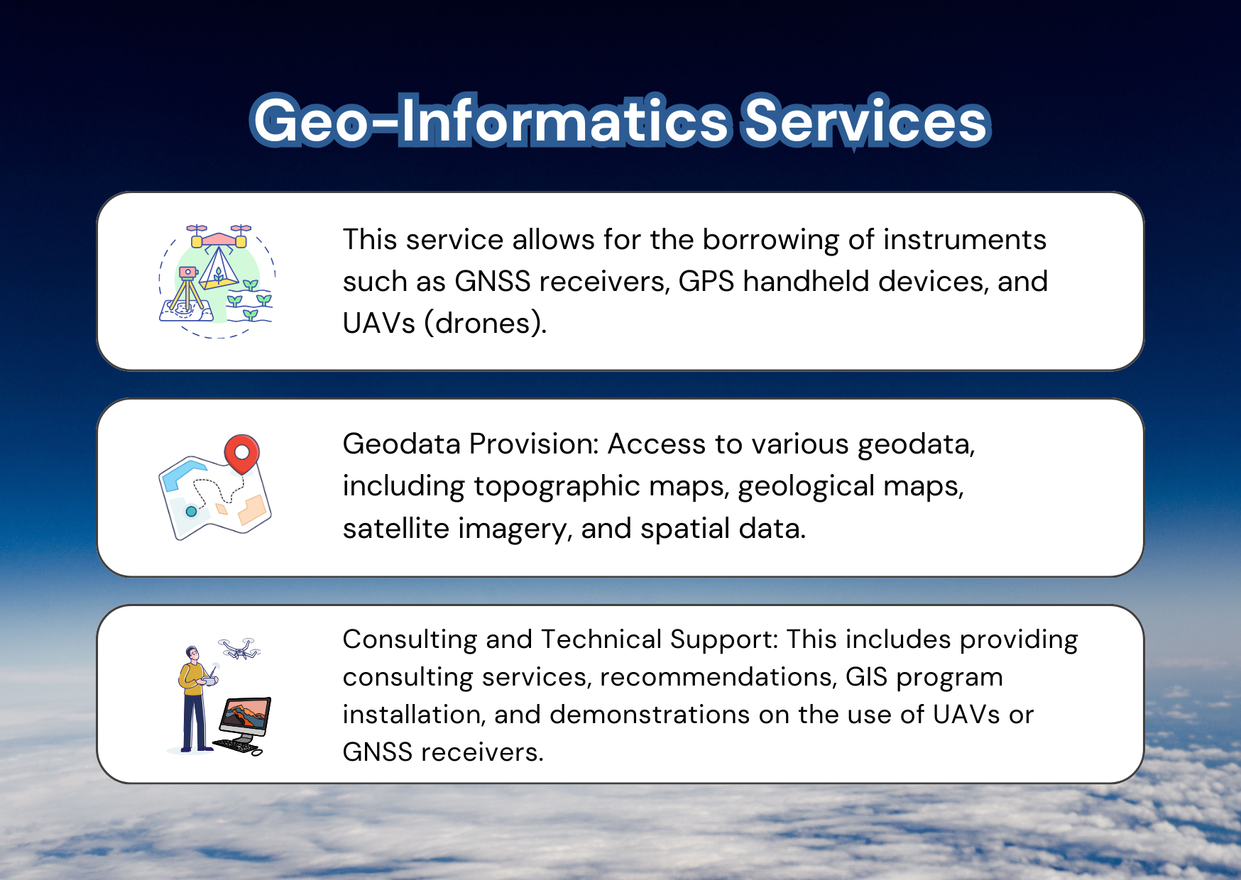
Geo-Informatics Services
The Geo-Informatics Services are provided by
the Information Unit, General Administrative,
Faculty of Environment and Resource Studies,
Mahidol University.
![]() Announcement of the Faculty of Environment and Resource Studies Regarding Criteria and Rates for Maintenance Fees for the Use of Geo-Informatics Equipments and Services 2024
Announcement of the Faculty of Environment and Resource Studies Regarding Criteria and Rates for Maintenance Fees for the Use of Geo-Informatics Equipments and Services 2024 ![]()
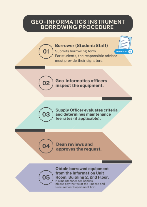
![]() Geo-Informatics Instrument Borrowing Form
Geo-Informatics Instrument Borrowing Form
![]() Geo-informatics Service Request Form
Geo-informatics Service Request Form
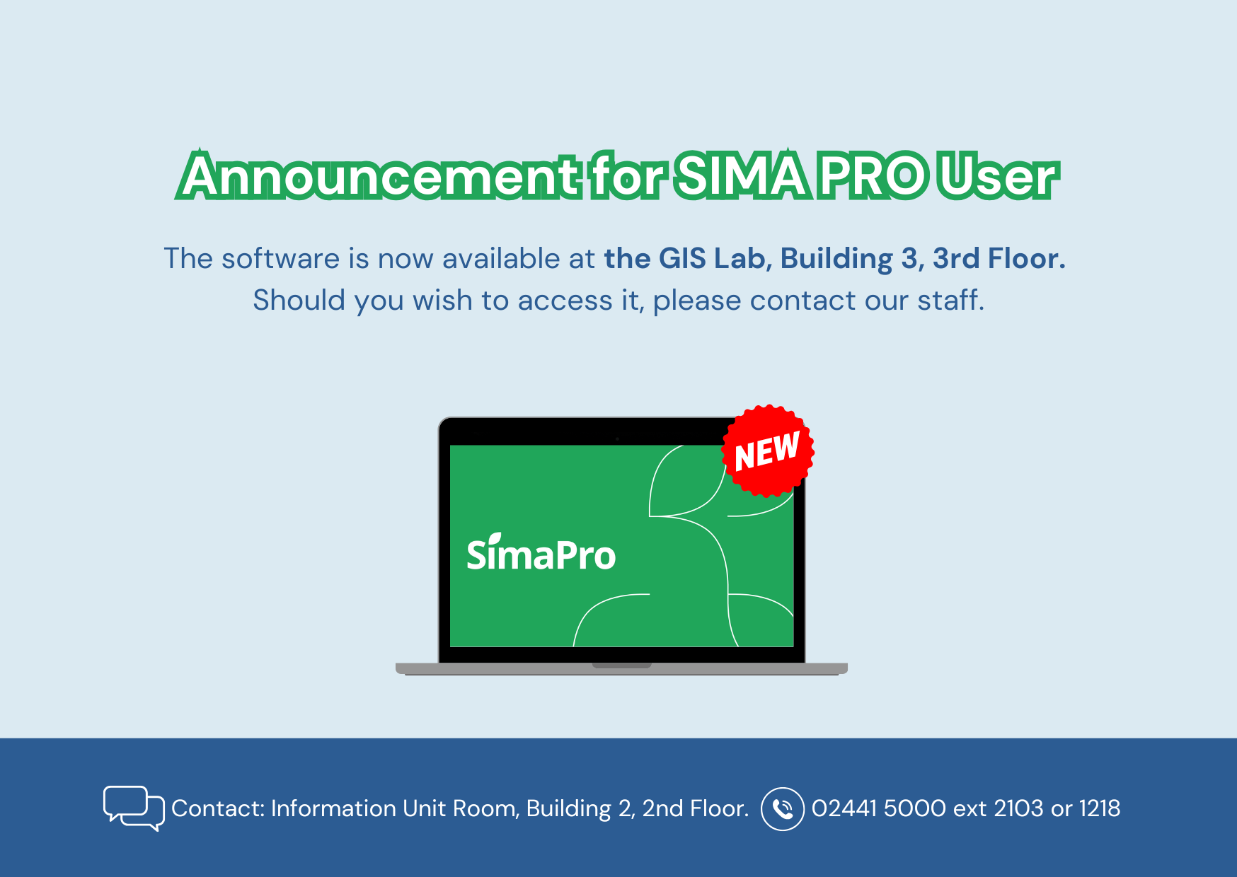
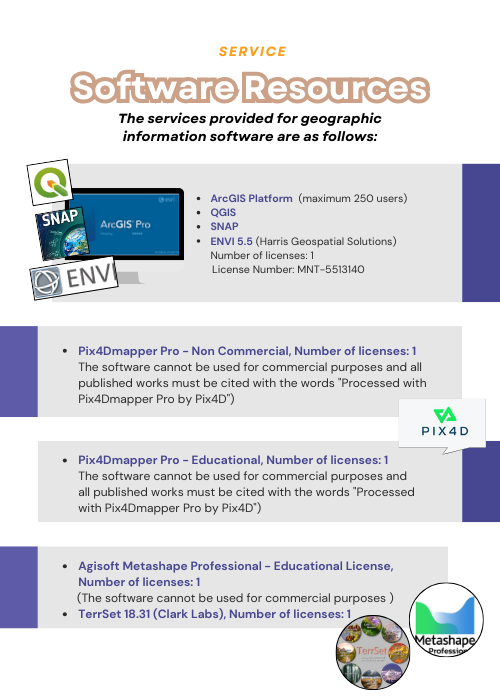
![]() List of Available Geo-Informatics Software Resources
List of Available Geo-Informatics Software Resources


